
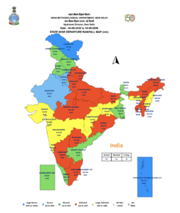
After an early and promising start, India’s southwest monsoon has unexpectedly slowed its progress, leaving several regions with below-normal rainfall. Weather experts say the delay is not caused by a single factor but by a combination of atmospheric conditions.
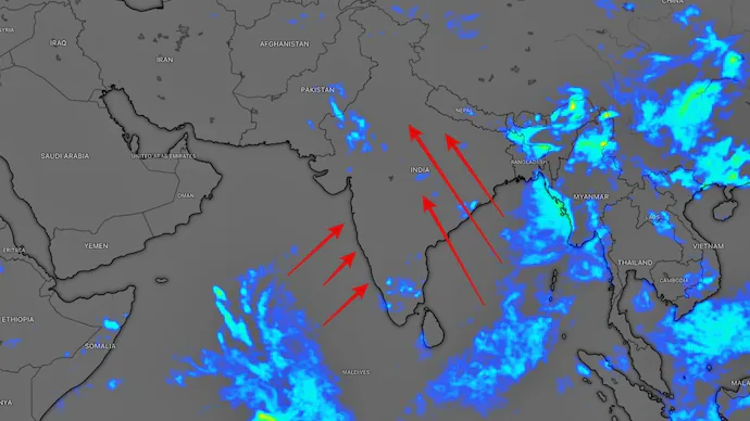
One major reason is the activity in the western Pacific Ocean. Some of the moisture and energy that usually helps strengthen the monsoon over India was pulled toward developing tropical systems in the Pacific. As a result, the Bay of Bengal failed to generate the low-pressure systems that normally help the monsoon advance.
At the same time, repeated Western Disturbances brought dry winds into northern India, making it harder for clouds and rain-bearing systems to develop. The monsoon trough also remained weak, preventing thunderstorms from organizing effectively.
Adding to the challenge, the Madden-Julian Oscillation (MJO), a weather pattern that often boosts rainfall, stayed in an unfavorable phase during the first half of June. An emerging El Niño has also contributed to less favorable conditions for widespread rain.
Despite the current slowdown, meteorologists remain optimistic. Weather models indicate that conditions may improve during the final week of June as key monsoon-supporting systems strengthen. If this happens, rainfall activity is expected to increase and the monsoon could regain momentum across many parts of the country.
For now, farmers and water managers are closely watching the skies, hoping for a strong monsoon revival in the coming days.